History of St Enoder Parish

St Enoder Parish lies on the northern fringes of the China Clay Area. It covers a total of 3,567 hectares and its principal settlements are Fraddon, Indian Queens, St Columb Road and Summercourt. Positioned at an important juncture in central Cornwall, the Parish is crossed by a series of trunk roads; the A30, the A3058 (Newquay-St Austell), the B3275 and the A39.

The present extent of the Parish only dates to 1981 when a boundary review merged the historic Parish (Fraddon, Summercourt and surrounding hinterland) with part of St Columb Parish (Indian Queens, St Columb Road, Trevarren and associated areas).

The Parish has been occupied for many thousands of years, demonstrated by the survival of prehistoric monuments such as settlement enclosures throughout the older fieldscapes in the area, and burial mounds found during the construction of the Indian Queens/Fraddon bypass.

The actual churchtown of St Enoder was first recorded in the Domeday Book of 1086 as ‘Heglosenuder’ – Cornish for the Church (‘eglos’) of Enoder, a male saint whose feast day was held on the Sunday nearest to the last Thursday in April.

Three farming estates were also recorded in the Domesday book. These were Burthy, Carworgie (Indian Queens) and Arrallas – an important site which takes its name from the Cornish for Silver Court (‘arghans’ and ‘lys’). Place-name analysis and other research has shown that many other settlements, particularly those including the element ‘tre’ meaning farmstead, such as Trefullock, Tresithney and Trevarren, are also over one thousand years old. Throughout the Middle Ages, this very rural network of medieval farms and hamlets formed the very basis of community life. At this time, there was also a greater extent of unenclosed downland or moor which has subsequently been hedged in.

Fraddon was first recorded in 1321 as ‘Frodan’ and is believed to be named after a streamlet (‘frodynn’) while Higher Fraddon was first recorded in 1510 as ‘Frodan Wartha.’ The place-name Summercourt was not recorded until 1711, though it is certainly much older than that. The village is famous for its annual fair and the presence of an important fair in the Parish was recorded as early as 1227 (‘Longaferia’) or 1351 (fair of ‘Langchepyng’) from the English long fair or ‘cieping’ market. There is also a local tradition of a fair at Penhale.

Summercourt Fair
Summercourt Fair In The Late 19th Century

Indian Queens Band
Indian Queens Band in 1896

Turnpike Acts passed through Parliament in the 18th century and this had a major impact on St Enoder Parish. In 1759, a turnpike road was constructed from Launceston to Truro, via Camelford, Wadebridge and St Columb Major. This road included New Road to the west of Fraddon. A more direct route was constructed by about 1769 which included a new road across the Goss Moor to link with the northern turnpike near Fraddon. Prior to the improvements, the main road across Goss Moor went through settlements such as Belowda. An anonymous diarist writing in the late 18th century described the new road as “11 miles of the most excellent road mostly upon a level. All moorland, not a tree to be seen on this road.”

In 1775, Francis Symons took out a 99 year lease on a six acre plot called White Splat on Carworgie Common (on what is now Chapel Road, Indian Queens). He and his family enclosed and improved the land and set about erecting and running an inn on the site. By 1780, the inn was known as The Queen’s Head. On a ‘new map of Cornwall’ produced by William Tunnicliff in 1791, it was shown as the ‘Indian Queen Inn’ and in 1802, it was documented as “a single house … which is rather a post-house than an inn.”

A railway line through the Parish, built by Joseph Treffry, was completed in 1849 and extended from Newquay Harbour to St Dennis. The Cornwall Minerals Railway opened its line from Fowey to Newquay in 1874, incorporating Treffry’s Newquay Railway. Initially, the trains travelling to and from Newquay continued to carry only goods traffic but a passenger service was introduced in 1876. St Columb Road Station was originally known as Halloon but was renamed in 1878. In the 1870s, a separate line known as Retew Branch was constructed though clay works to Mellangoose Mill in the very south of the Parish

The inn at Indian Queens and the station gave their names to the new settlements which grew in size through the 19th century and into the 20th century, primarily as ribbon-development along the roadways. In the nineteenth century, the area around the Blue Anchor also took its name from the pub with the main built-up area of Fraddon being further to the north.

As well as agriculture, mining has played a considerable role in the economic life of St Enoder Parish. This has included tin streaming operations on Goss Moor and at Gaverigan and mines for tin, iron and ochre. Physical remains of some of the mines still survive which include the stacks of Parka tin mine and the Toldish paint (ochre) mine, the engine house of Toldish tin mine, the spoil heaps of the Penhale Moor tin mine as well as the open work of Fatwork and Virtue which was converted into Indian Queens Pit (non-conformist preaching pit) in the early 1850s.

China clay extraction became a prime source of employment and a number of china clay operations opened up in the Parish in the 19th and early 20th centuries which included Anchor, Halwyn, South Fraddon and Wheal Retallick. Associated with some of these early pits, there were also a number of brickworks which included Burthy, Chytane, Gaverigan, Wheal Remfry and the St Columb Road brickworks which was positioned beside the railway station.

Most of the early china clay workings have now been incorporated into Wheal Remfry and Melbur pits which continue in operation in the southern part of the Parish.

The main settlements were by-passed in the early 1990s and over the last fifteen years, there has been considerable housing and related growth, particularly around Fraddon, Indian Queens and St Columb Road. As well as the new housing, the central location of the Parish has meant that a considerable amount of employment land has been positioned to the east of Indian Queens close to the A30 which is still being built out.

A Growing Population

Over the last twenty-five years, the population of St Enoder Parish has probably increased more than any other area in Mid Cornwall.

In 1981, the population of the Parish was 2,865 people. This had increased to 2,975 by 1991 but by 2001 this had gone up to 3,819 [1] and continues to rise at a considerable rate. Comparison of recent electoral rolls with the 2001 census data would suggest that the present population of St Enoder Parish is approaching 4,500. This shift in population is shown by the fact that 52.6% of respondents to the questionnaire had lived in the Parish for less than 15 years.

Such a growth in population has had a considerable impact on life within the Parish, local facilities and the manner in which local services are provided.

[1] Census returns for 1981, 1991 and 2001.

Pit workers at Trewhela
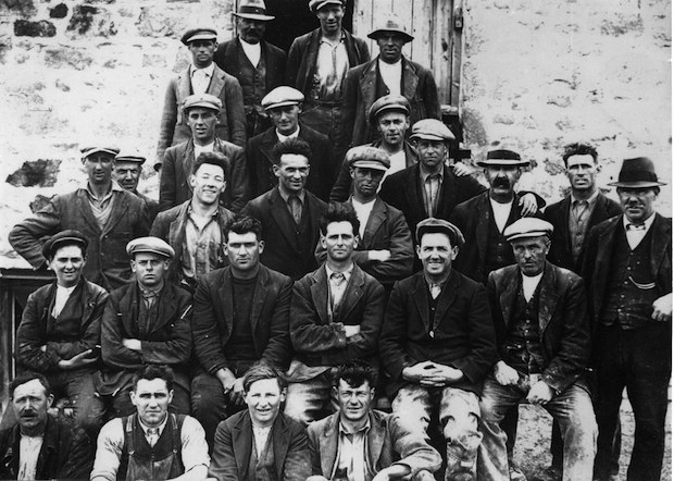
Workers At Trewhela Clay Works, Fraddon circa 1930